Sammamish Data Systems Inc
postal carrier route boundaries and centroid maps for marketing your business
Whats Behind the Map
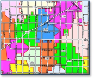
It's true; a picture is worth a thousand words. That's what makes mapping so powerful, and makes mapping such a tremendous asset for so many companies. From Direct Mail to Insurance Damage Assessment to Market Territory Development and Analysis, mapping brings you clarity for strategic decisions. Sammamish Data Systems geographic files help you meet that challenge.
The framework of your map needs to provide you with highly accurate, useful geography. Sammamish Data Systems, for the last 30 years, has been a leader in this field.
We build and own our geographic files, so we can give you the best accuracy and the best price – a winning combination for our customers.
Our map experts can incorporate your customer database and marketing areas to better display market penetration, and help you better understand you customer profiles. From radius repots to ZIP + 4 based buffer zones; we’ll be able to support your specific map requirements.
Map Yourself
Our files allow you to map your own projects with your current mapping software (GIS) or use our own mapping software, which can be customized to your specific application. Our geographic files come in a variety of industry standard formats in order to work in your current mapping software. Protect your investment. Choose Sammamish Data Systems as your provider of geography.
Need Technical Support
Great! We provide it free of charge. Just Contact Us.
And if you’re thinking of implementing mapping for the first time, we’re here to help. We provide “Kick-Start” teleconferences just for you – and again, at no charge. We’ll help you create map templates with the formatting and fonts that you prefer, and you’ll save hours of time by not re-creating the wheel for each new map!
Are you an existing customer that wants to expand your mapping prowess? We’re here to enhance your mapping techniques to grow with the needs of your company. We look forward to hearing from you again.
Mapping Examples

see more map examples