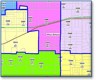
Postal Carrier Centroid
SammData Carrier Route Centroids are based on the most accurate Postal Carrier Route boundaries available! First, we split Census Blocks to create our boundaries, and then create our geographic centroid file.
Overview
Our Postal Carrier Route Centroids are based on our exact Carrier Route Polygon Files. This file gives you a quick and practical way to see a general overview of a large metropolitan area easily identifying your market.
This extremely accurate and detailed file is ready for use with most desktop mapping systems, including GeoSight, MapInfo, and ArcInfo/ArcView.
Our Carrier Route Centroid file includes:
- A postal count file containing total addresses, homes, apts, PO Box and business counts.
Geography Levels
Available by State, Region, or the entire U.S.
Update Schedule
Available with Monthly, Quarterly, or Semi-Annual updates – remember we can create the most current, custom .pdf or hard copy maps for you!
For pricing, detailed file layouts, or questions, contact us
